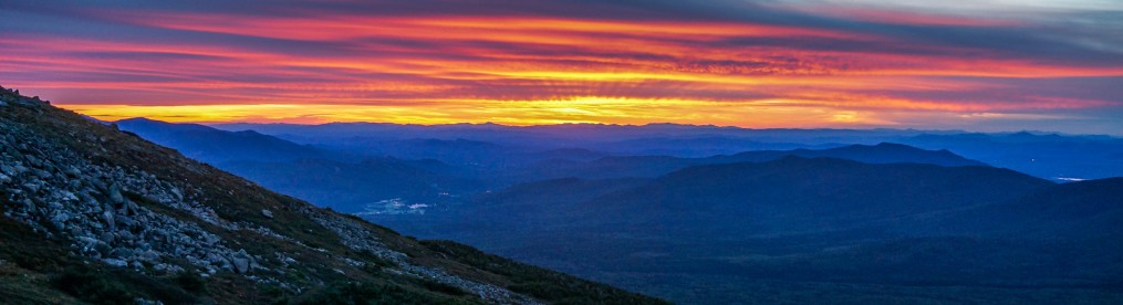


“How long will my pregnant body keep letting me climb mountains?” I wasn’t sure what the answer was going to be, so I decided I better plan any big climbs sooner rather than later. That put Mt. Washington, the tallest peak in New England, at the top of my list. Mt. Washington is infamous for having some of the worst weather in the world, and I’ve hiked it in really nasty weather, but for this hike I watched and waited for a GOOD weather window.
Eventually the general forecast and Mt. Washington Higher Summits Forecast agreed that the weather would be perfect hiking weather so I prepared to head up to the Whites for the night and then get an early start to my hike the next morning. There was just one problem :( Pregnancy, even in the second trimester, sometimes comes with a side of nausea and vomiting, and the day I was planning to drive North to the Whites was one of those days when food was not agreeing with me… So instead of heading to the mountains, I curled up with my favorite electrolyte solution, and postponed my hike.
Luckily by the next day I was feeling fine again, and miraculously the weather on Mt. Washington for the following day looked agreeable, so I only had to delay my trip by a day.
Trip Report: Solo Mt. Washington Loop @ 24 Weeks Pregnant
- Date: July, 2021
- Activity: Solo Day Hiking
- Difficulty Level: Strenuous
- Trail Name(s): Mt. Washington Loop Via the Ammonoosuk and Jewell Trails (~9.2 miles total, ~3,809′ elevation gain)
- Ammonoosuk Ravine Trail to Lakes of the Clouds Hut (3.1 miles, difficult)
- Crawford Path (AT) to the summit of Mt. Washington (1.5 miles, moderate)
- Gulf Side Trail (AT) from the summit to the Jewell Trail (0.9 miles, easy)
- Jewell Trail to the Ammonoosuk Ravine Trailhead (3.7 miles, difficult)
- Location: , White Mountains National Forest, New Hampshire
- Access and Amenities: Parking available for a $5/day fee at the hiker parking lot. Outhouse available at the parking area.

Ammonoosuk Ravine Trail
I got an early start and was on the trail by 5:30 am. Although I was confident that I could still climb Mt. Washington, I wanted to give myself plenty of time so I could take whatever leisurely pace my body needed… Also, the weather for the morning looked better than the weather for the afternoon.
Although the Ammonoosuk is either rocky, rooty, or both from start to finish, the first mile of trail from the parking area to the side trail to Marshfield Station (and the Cog) has very little elevation gain and is generally easy and went by quickly. From there, the trail follows the Ammonoosuk River another relatively easy mile (gaining about 500ft elevation) to Gem Pool and cascade. I knew from there the trail was going to get quite a bit steeper, so I stopped to take a break, eat a snack, and adjust my layers.
At the pool I ran into another solo female hiker that was going about the same speed as I was, who was also stopping for a snack.
“You know, the best cascade of the trail is just a little bit further up, on an unmarked side trail to the right. Have you ever checked that one out?” she asked. Although I’ve hiked the Ammonoosuk Ravine Trail at least a dozen times, I was usually hiking it in the winter and couldn’t recall having ever checked it out before.
“I’ll check it out,” I smiled as I headed up the trail and she stayed at the pool to finish her snack. Although it was less than 0.2 miles (my GPS said 0.16 miles and ~300 feet of elevation gain) from the pool to the unmarked trail, it was steep and my new friend caught up with me well before I got there.
“Would you like to pass?” I asked, “You’re definitely going faster than I am on this steeper stuff.”
“No, I should slow down,” she replied, “if you don’t mind the company, I’ll join you for a bit.”
I told her I didn’t mind the company, and before long we came to the cutoff for the waterfall. The trail to the waterfall was a couple of hundred feet long and downhill the whole way, but I was curious and my new friend highly recommended it. It turns out she was right, it was definitely worth the detour. The photos don’t do it justice. The cascades start a couple of hundred feet up and tumble down two paths into a pool where the trail comes out, and you can see that the cascade continues out of sight below you as well. It is easy to imagine it’s path cascading the rest of the way down to the Gem Pool.

We took a moment to take in the waterfalls and photograph each other before heading back to the main trail and the climb ahead of us.
There’s no doubt that as each week in my pregnancy passes I get slower and slower going uphill, but it was such a phenomenally gorgeous day that I didn’t want it to go by too quickly anyway. Besides, it was nice having the company of a new friend to talk with as I climbed.

As we emerged above tree line we were met with phenomenal views and the added bonus of an array of wild flowers in bloom.
It seemed strange to see flowers where I was used to seeing ice. However, the trail felt just as steep in the exposed sections in the summer as it does in the winter when it is covered in ice and requires crampons. Even though it is steep, I was reminded that one of the great things about the Ammonoosuk is the distinct lack of boulder fields you frequently encounter on other routes up Mt. Washington.

Once we got above treeline, the rest of the distance to the Lakes of the Clouds Hut went by quickly.
Crawford Path (The AT)
We stopped at the hut, ate snacks, rested, refilled out water bottles, and used the restrooms before setting off on Crawford Path (aka the AT) for the remaining 1.5 miles climb to the summit.
I was still in awe of our luck with the weather. When I had hiked this section of trail on my AT thru-hike in 2013 it was cold, windy, and foggy… I was lucky if I could see 10 feet in front of me. Today, however, the weather was perfect. Sunny and warm, but not to hot, and most amazingly of all there was almost zero wind! In short, it’s the kind of weather that is almost unheard of on Mt. Washington.

The trail to the summit was rocky but relatively easy, but it was uphill and I was still moving fairly slowly. The weather was so nice, and we’d gotten an early enough start that we could linger above tree line appreciating the views and not have to worry much about the time.


The Summit
Surprisingly, we hadn’t run into much in the way of crowds on the trail even though it was a Saturday with gorgeous weather. That changed, however, when we reached the summit. Between visitors from the Cog Railway and the Auto Road, the summit itself was absolutely mobbed… Although I expected it to be crowded, it’s been a very long time since I’ve been on top of Mt. Washington on a beautiful sunny summer weekend and I had no idea that nowadays you have to stand in line if you want to take your photo at the sign on the summit.
I took one look at the summit line and decided I’d skip it. However, my new friend convinced me that the line would move quickly and since I’d hiked all the way up to the summit I might as well take the extra breather, wait in the line, and do the summit photo thing. It turns out she was right, it wasn’t too long a wait, and I was glad I did it.

Although my original plan had been to descend via the same route I’d come up, with the option of climbing Mt. Monroe on the way down, I’d been tempted to descend via the Gulf Side Trail (the AT) and then the Jewell Trail to check it out. My friend’s original plan was to descend via the Cog railway, but it was so nice out she decided she was going linger above tree line and hike down via the AT and Jewell Trail. Unsurprisingly, by the time we’d finished our snacks at the summit we’d decided to hike down together.
The Gulf Side Trail (The AT)
Leaving the summit along the Gulf Side Trail we immediately got rid of the crowds and found ourselves enjoying the views of the alpine meadows and spectacular views of the Northern Presidential Range. We couldn’t complain. In addition, my new hiking buddy was a birder, and she pointed out some rare alpine birds as we meandered down the trail towards the Jewell Trail.

The Jewell Trail
By the time we got to the trail junction for the Jewell Trail, the trail had become quite rocky and I remembered my parents advice:
“You don’t want to go that way! It’s a nasty boulder field. Been there, done that, would not do again.”
It turns out my parents were right, the top part of the Jewell Trail is definitely a slog through a boulder field. I was definitely glad that I’d put both of my ankle braces on for extra support, and that I had my trekking poles with me. Also, I was glad to be going DOWN the boulder field and not UP it. I think if I’d been going up it would have felt like the boulder field went on FOREVER.

As it was, it was slow going, but my joints felt fine and I was so glad to be above tree line and having a spectacular hike that I didn’t mind too much.
By the time the trail descended below tree line the boulder field subsided into the standard rocks and roots that you’d expect of a New England trail. So I would say that the trail from there was relatively good, but I was definitely getting tired.
The final mile of trail from the junction for the Marshfield Station to the Trailhead Parking lot was some of the most easy going trail you’ll find in the Whites. Despite that, my feet were decidedly sore… more sore than they’d been in a long time, and I was looking forward to getting off of my feet, eating a ginormous meal, taking a shower and heading to bed.
Although I was exhausted from the days hike, by the time I’d driven back to my refuge for the night I was already starting to plan my next hiking adventure… Surely if I could climb Mt. Washington while pregnant I could get in some more backpacking this summer too ;)
")


